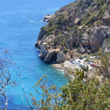
Cape San Antonio, Xàbia and Cala del Moraig (cove)
By car from Dénia, take Les Rotes road and turn off to Xàbia. Carry on along the mountain road known as Les Planes for about 10 minutes until you come to a left turn signposted Cabo de San Antonio. Be sure to drive very carefully on this bendy mountain road.
San Antonio Cape
160 m high cliffs with fantastic views.At the foot of the cliffs lies the San Antonio Marine Reserve, a protected area of special environmental, scientific and ecological interest and importance. Fishing is prohibited in this Reserve, and underwater diving is permitted only by prior license (apply at Dirección Territorial de Agricultura y Pesca in Alicante). The waters of the Marine Reserve are home to a large number of ‘benthic’ communities, such as the infracoastal community of epiphytic algae, the Posidonia meadows, etc. It provides a habitat also for many species of marine fauna such as grouper fish, sea cicadas, gorgonias, etc.
At Cabo de San Antonio, the water below you seems immense and a deeper blue than you have ever seen before. On a clear day, you can even see the island of Ibiza in the far distance. Enjoy this beautiful view for a while, and then continue on towards Jávea town. Worth a visit on the way are the old windmills which are such a treasured part of the heritage of this area.
Xàbia
Recommended route. The town of Xàbia is made up of three separate districts: the Old Town, the Port and the Arenal Beach.
The old town is well worth a visit, three buildings being of particular interest: the Indoor Market is an old convent recently restored, San Bartolomé church, built in the late Gothic style, a declared National Historic Artistic Monument and Asset of Cultural Interest, and the Town Hall of Xábia itself.
Having spent some time admiring these three historic buildings, go down the steps beside the Town Hall to the delightful Plaza Porticada (arcaded square), where you can have a look at the rear façade of the Town Hall built of local Tosca stone, and the newly constructed Casa de la Cultura. From here the route continues to the Museo Arqueológico y Etnográfico Soler Blasco (the Archaeological and Ethnographical Museum) which is only about 1 minute away on foot. Continue along Calle Mayor, and go up the narrow street on the right hand side, which leads straight to the museum. You will recognize it easily, because it ́s housed in a town mansion dating from the early 17th century, known as la Casa de Felipe Bañuls.
After this interesting visit, continue on down to the port where you will find the unique Iglesia de Nuestra Señora de Loreto (Church of our Lady of Loreto). This church is outstanding for the design of its roof in the form of an upturned boat and for its exterior columns representing the twelve Apostles.
Optional trip around Jávea
We would like to mention the 15 Miradores (Lookout Points) in Jávea. However, you will probably need a full day to visit all 15 of them. The lookout point route begins on the Cabo de San Antonio and ends up at La Granadella cove, covering a distance of 25 kms. of coastline.
Cala del Moraig (cove) and Cova dels Arcs (cave)
Follow our route towards Poble Nou de Benitatxell and the well-known Cala del Moraig (cove) and Cova dels Arcs (cave). It ́s best to get there before nightfall because the quality of the light here brings out to the full the beautiful colours of the landscape.
From Jávea follow the signs for Gata de Gorgos and Poble Nou de Benitatxell.
The coastal strip of Poble Nou de Benitatxell is especially attractive because of its sheer and precipitous cliffs, towering to a height of more than 100m. On the slopes of the Sierra de la Llorença archaeologists discovered the remains of the first kilns used by the villagers in ancient times to bake the mud to produce tiles. The highest point is Puig Llorença, reaching 440m.
To get to Cala del Moraig and the Cova dels Arcs, follow the signs in Benitatxell for the Urbanization Cumbre del Sol; when you pass this Urbanization, carry on until you reach the cove.
The Cala del Moraig and the Cova dels Arcs. The cove is stony and the colour of the sea changes imperceptibly from green to blue. At the far end of Cala del Moraig is the Cova dels Arcs, one of the most important marine caves on the Alicante coast. It is one of the best examples of Karst drainage where continental or coastal conditions have produced natural underwater formations. You will be left in no doubt about the exceptional beauty of this place.
A few metres away from Cala del Moraig is Cala dels Testos, a cove formed by the drainage from the Barranc de l ́Infern (Hell ́s Ravine). This is a small, inviting cove, almost inaccessible, but of great beauty. To get here you have to follow the course of the ravine on foot, because there is no road access. Next to it you will see the Morro Falquí, a rock spur rising more than 100m above sea level, named for the many hawks which used to nest here. Just before you reach the cove, on the cliff top, you will see the Cova dels Testos cave, where you get marvelous views of Moraira Point, the cliffs and the Moraig beach.
Countryside
The Benitatxell municipality is an agricultural communi-ty with a network of slopes, valleys and hillsides almost totally terraced and planted with vines, almond groves and carob trees, although the prin-cipal crop of the area is the muscatel grape


